r/socalhiking • u/AdhesivenessNo6963 • 10h ago
Most scenic hikes in LA area?
2
Upvotes
Just got into hiking recently. What are the most scenic hikes in LA? As distinguished from most popular, which I don’t care about. Thanks!
r/socalhiking • u/AdhesivenessNo6963 • 10h ago
Just got into hiking recently. What are the most scenic hikes in LA? As distinguished from most popular, which I don’t care about. Thanks!
r/socalhiking • u/Aggravating_Bus_3433 • 18h ago
Forecasted rain didn’t come. Was beautiful mid-50s didn’t use my beanie and layers at all. Trees are magnificent and it was a spiritual experience hiking by myself very little people on the trail.
r/socalhiking • u/cjspeak • 1d ago
When did the influx of this sort of trend start? The all black fits, Artcyrex beanies and rainjackets in peak summer. I saw a post the other day about a dude who lost his Cerium (a very warm down jacket) on San G. It is not nearly cold enough to necessitate that.
My biggest concern is how this will manifest in the winter. It seems like these people would very impressionable to viral “aura” mountaineering content and think they could do the same without skill/planning/equipmenr. How can we as a community try and put more information out there about proper winter hiking procedures?
I don’t want more people to needlessly die, but I’m also against the whole blanket closures they did last seaosn whenever there was a storm.
r/socalhiking • u/bookkeepingthrowaway • 1d ago
r/socalhiking • u/IonaScott46 • 1d ago
r/socalhiking • u/Few-Win8613 • 1d ago
Hiked beyond the main palm grove retracing my steps from spring when the water was flowing. Route finding came a lot easier this time around, but I often got confused without the water pouring down the canyon. I didn’t get as far as I did last time, but found a suitable backcountry camp spot and made myself a coffee. A light drizzle came and went the entire morning as I spotted small pools of water atop certain boulders. Headed to Mine Wash for some mortero hunting; an activity that seemed appropriate on Indigenous Day. I just love how easy they are to spot after a rain. Great day out in the desert.
r/socalhiking • u/JoeHardway • 1d ago
For them that care to seeit all:
https://photos.app.goo.gl/iGFXm23uNgV73aDW9
So! W/TS Rachel havin dropped copious amounts of rain, all over SoCal, it seemed like alotta targets mightbe in-play, IF we could strike whilst the iron was hot...
Spent some time analyzin rainfall totals, n comparin standout areas, agin targets in my mental Rolodex, to come up witha hitlist...
I settled upon'a really nice cataract, abit W of tha 15, intha “Rainbow” area, that I've had my eye on for'a minute, as tha primary, witha 2ndary target abit E of tha 15...
Our primary had some potential access issues, but I'd thoroughly scanned available imagery, n I felt like we had'a solid “backdoor” route, that'd avoid pryin eyes. But! No battle plan survives 1st contact w/the enemy, and, intha case of our primary target, “1st contact” was findin that tha rd thatwe intended to use as our parkin spot, and our ingress into “injun country”, rather'n havin'a cable gate, n tha tall brush, depicted ontha most recent street view imagery, was now ungated, pretty clear, and, with RECENT tire tracks! This was rather disconcerting, as our whole plan hinged upon this area bein vacant...
We decided to probe abit further up tha main rd, n I'llbe damned if some1 hadn't plopped'a “Tiny House”, smack dab intha middle of our ninja route! Vehicles parked there, n dogs came out to meetus, n'it was clear tha jig was up! Ughh! It was clear this area'd had ALOTTA rain. Maybe not enuff to have much stayin power, given how DRY it'd been b4 tha storm, but, IF we'd been able to proceed w/tha mission, I KNOW we wouldabeen rewarded handsomely...
But! These new developments were'a deal-breaker! On to Plan B...
Man! Those backroads around Rainbow'r a seemingly labyrinthian cobweb of sketchy, NARROW, mountain roads. N/U can't always trust google to givu a viable route, to wheru wannabe...
After havin traveled aways, over hill n dale, we saw'a large (40’) boat, that “some1”’d hauled onto their property. Given tha roads we'd traveled to get to this point, imaginin HOW this'd been accomplished, was only slightly less of'a head-scratcher, than wonderin about tha construction of “Tha Great Pyramids”. We documented tha curiosity n pressed onward...
Eventually, we came to our parkin spot, n were relieved to findit actually was suitable for this purpose. We parked n headed down tha rd abit, to where I'd ID'd as our likely ingress point...
This cyn was DEEP! Procedin w/this plan was gonnabe a significant commitment, requirin stealth, n abit'a luck, ifwe were 2b successful...
But! As I scanned the area, in spite'a the evidence of significant rainfall, I cun't detect any sound'a fallin water, and, with our target falls, bein easily a 30'r, with 2 forks convergin, I really felt like I shoulda! My spidey senses were tellinme we were gettin set-up 2b skunked, n I really din't wanna squander tha remains of our day, on sum'n that din't seem too promisin, so we opted to head back toward civilization, n find another target, that seemed promisin, n 1 we could reasonably hope to bag, w/tha daylight we had left...
Oncewe got close to 15, n had good signal, I began feverishly scannin for targets, givin preference to stuff I already had tagged, but, keepin my eyes open to “new opportunities”...
We were now way past strikin whilst the iron was hot, n I feared, even targets which mightabeen musterin'a respectable flow, earlier, were runnin dry witha quickness. We'd likely hafta temper our xpectations abit...
Prettymuch evrything I'd tagged, in this area, was just too GD hard to get to, n, at this point, we needed'a “quickie”...
After abit, my eyes locked-on to'a rocky cataract, abit NW of San Pasqual Valley. It seemed likit had'a decent chance to hava slimy trickle, n we might actually be able to findaway in...
We headed that way, n founda parkin spot, that seemed “ok”, n we headed up tha cyn...
Had to deal with abit'a brushy, crkbed bs, but, ere long, we were at tha mouth of our cyn...
It was pretty, but also, pretty dry, andit appeared 2b abit more technical than we'd bargained for. Oh well? This was our last chance to put some points ontha board for 2day...
There actually was ali'l water comin down. It was fannin out across tha rocks, down here, sowe cun't actually SEEit flowin, per se, but I figured ifwe found tha right bedrock features, higher-up, that'd change...
Tha 1st section was easily climbed, but then we had to negotiate a slick slot. But! With abit'a teamwork, we were soon astride tha top'a tha 1st level, butit was clear we had our work cut-out 4’us...
Nothin insurmountable, but tha technical stuff din't really let-up, n we were solvin prob's 4tha duration...
At 1 point, as I entered a narrow slot, I heard'a buzzin comin fr tha L, n, sure enuff, it waza beehive! Thought they mightbe settlin-down for 4'tha nite, but I soon observed lotsa in/outbound traffic. We briefly considered another route, ontha other side'a tha cyn, but opted to try'n sneak thru, below tha “guns”, which seemed to work...
This slot was another super-fun scramble, but, oncewe topped-out, we were nearin our cutoff time, and it'd sprinkled abit, n tha thought of traversin all tha technical stuff we'd just up-climbed, with wet rock, din't seem too appealin. There waza large chockstone up ahead, n we agreed we'd investigate beneathit, n head for home...
Lotsa sand below tha chockstone, so no pool, n only acouple faint ribbons of water, comin down. Still more technical stuff, but we opted to keep our agreement, n callit a day...
SAT imagery of this cyn was taken at HIGH-FLOW, soit reveals TONS'a potential, far beyond tha point wherewe calledit quits. But! Any attempt to navigate tha watercourse, with significant flow'd be'a tricky affair. Mightbe better to climb up along tha rim, n play peekaboo with tha standout features.
It's def ontha list 4'a revisit...
r/socalhiking • u/Ok-Decision-1120 • 1d ago
Going to attempt baldy going the baldy bowl route this Tuesday morning 10/13, anyone have a real concern with the terrain being messed up, me and my hiking buddy are not worried about the difficulty of the hike, as we both are fairly competent hikers and have personally logged ide have to guess 250+ miles together in the past 6-8 months, we have yet to do a real high country adventure together though. Im mostly worried about the loose soil, but ive heard baldy bowl is not as sketchy as the backbone, (also dont want to go through the makeshift repair that guy made on YT🤣). Just gathering opinions from everyone! Love feedback/criticism so feel free to give honest feedback, Much love happy hiking everyone!!
r/socalhiking • u/RowZealousideal6247 • 1d ago
I am a lover for hikes that feel impossible from the trailhead. This will be up there with some of the longest single day pushes I’ve done. I am experienced in hiking/mountaineering and have done several ultra-marathon distance hikes in the past. I live in the Sacramento area where 100°+ is very common and I’ve gotten used to hiking in the heat. I also summit at least one peak in Tahoe and surrounding areas nearly every weekend, and have done 2 14ers this season, so I am pretty well acclimated to altitude. The only question mark for me is how much water storage to bring. I will have a water filter.
If anyone could fill me in on what the longest stretches without water are and where in the trail they are so I can plan that would be extremely helpful. I want to keep my pack as light as I can while ensuring I have enough water to complete this beast safely.
Any other tips are welcomed also.
Thanks in advance.
r/socalhiking • u/ClimateSwimming7401 • 2d ago
First time doing gorgonio, going to camp the summit overnight.
What do I need to know about summiting in November, I know it’s a transition period from fall to winter conditions
“Super El Niño” might have an affect on snow fall.
Any advice is helpful
r/socalhiking • u/bigtimechud • 2d ago
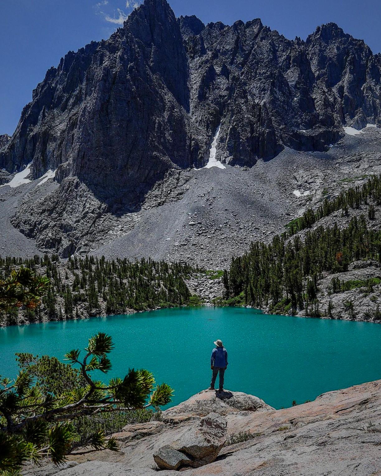
Not fully Hengst peak but just slightly to the right of it, such a beautiful lake aswell for only a couple miles!!!
r/socalhiking • u/_sartgr • 2d ago
I’ve just recently gotten into hiking this year and I’ve only been on a couple of short 2-3 mile hikes. Im 19 years old and I’d say Im in decent shape.
That being said I want to do Cucamonga peak, Ontario peak, and Mount Baldy seperate times in the coming months. I want to know if they’re really that hard or what type of prep I need. I feel like I can just do it but what do I know lol. Should I do some other trails to practice. Thanks
r/socalhiking • u/CrazySoCalHiker • 2d ago
Enable HLS to view with audio, or disable this notification
Super cold as well. Felt like it was in the 30s.
r/socalhiking • u/CrazySoCalHiker • 2d ago
Hike Stats: https://caltopo.com/m/VGPRT45
Great cloudy weather before the rain hit. Haven’t done a 20+ mile hike in almost 3 months. Picked off the White Mountains first as it was completely dark at 6 to take advantage of the coldness. Lots of flowers on the sides of the road. As I was getting close to South White, it started to get very windy. I accidentally missed the turnoff of South White, but I will return back so I went to North White first. Literally crazy winds up on both Whites. I have a video I will separately post so you can hear how crazy it was. Then came back for South White going up the steep almost 200 ft shortcut.
Got back to my car within 4 hours and 30 minutes then had a 15 minute intermission before going to Little Bear. With Little Bear done, I was going to Grays an alternate way instead of the main way, but I didn't know it was private property so it was back to the main way.
Not a fan of popular trails, but Grays was pretty quiet. About 30-35 people were on the trail with me. The winds picked back up when I got to Grays, and did a group photo with these fellow hikers and a dog.
Fly high Jackie, we will never forget you.
Next Episode: Pleasant View Ridge Ch8os
r/socalhiking • u/bottymc_botface • 2d ago
Left at 2 AM and made it up in 10 hours. Got to the switchbacks in time to watch the sunrise hit the front of the range. Gorgeous weather. So glad we left early, because it took everything we had to get back right before the sun went down. Got hit by light altitude sickness but kept pressing. An absolute slog but so worth it!
r/socalhiking • u/coconutwatersmoothie • 3d ago
Hello! I’m looking for a easy/moderate hike within an hour drive of Irvine that has a creek crossing (doesn’t need to be a big river). I have waterproof hiking boots and love an interesting creek crossing in a hike. Bonus points for a canyon or waterfall view. Extra bonus points if the path is natural/has big rocks; I am hoping to steer away from paved paths.
Ideally it would be a multi hour hike as well, maybe 3-6 hours. I appreciate any suggestions! Thanks!
r/socalhiking • u/Vegetable_Answer_599 • 3d ago
Is camping in Malibu Creek State Park tomorrow night (Sunday) safe given the rain and hurricane off the coast? The rain forecast looks light for the area but is anyone who’s familiar with the area aware of the risk of floods/road blockages?
r/socalhiking • u/Low_Obligation8616 • 3d ago
r/socalhiking • u/Acceptable_Music_651 • 3d ago
Hey guys, I hiked Baldy earlier this year, but I want to take my friend this time. What are the conditions like? When does it become a winter hike
r/socalhiking • u/Lives_on_mars • 3d ago
Looking to carpool for my partner who’s about to be stuck at the Whitney Campground after finishing the SHR. My car protests after about four hours so if you’re heading up to the Bay Area, or going even part of the way, please let me know!
r/socalhiking • u/ntrophimov • 3d ago
Yesterday I did a long hike from the Middle Fork trailhead to Cucamonga and Etiwanda Peaks.
I've explored the Cucamonga Wilderness before (Three T's, Cucamonga, Ontario, and Bighorn) and visited the hidden falls near the Third Stream Crossing, but I'd never done this particular route.
The trail is stunning and surprisingly diverse: you start in chaparral, pass through oak groves, and climb into pine forest. The views kept stopping me in my tracks, so I was constantly pausing to take pictures.
I saw almost no one, especially on the Middle Fork stretch, and it felt like I had the whole area to myself. One of the highlights was a gorgeous bobcat I spotted right in the middle of a hunt!
The trail is in good shape overall, but the Middle Fork section has a couple of narrow, steep slides that call for careful footing, plus a few downed trees.
The mosquitoes and flies were brutal, especially between the Third Stream Crossing and Comanche Camp. Shortly after Comanche, they stopped being a problem.
It took me just over 9 hours at an average of a bit over 2 mph. My Garmin logged 18.07 miles and 6,200 ft of elevation gain.
A great adventure that I highly recommend, but don't underestimate this route!
r/socalhiking • u/Spekski • 4d ago
Hey everyone,
I was thinking of climbing Mt Baldy this Sunday but seems like it’s going to be raining all day. I’m from the UK living in LA so I’m very used to hiking in the rain but I wanted to check how safe it is before attempting.
I’ve done the hike before when dry, but just want to make sure I’m not signing up for more than I can handle, if it’s overly dangerous I would probably hold off but if doable without too much worries I’d like to get back out to the taller peaks.
Thanks!
r/socalhiking • u/dizzystar • 4d ago
Think the FBI is going to come after me?
All seriousness, that's the largest balloon I've come across. It barely fit in my bag.